Imagine stepping from your patio onto a private dock, easing out through Gordon Pass, and reaching open Gulf water in minutes. If that vision speaks to you, Port Royal in Naples delivers one of Florida’s most coveted waterfront lifestyles. You want beauty, convenience, and smart guidance on what makes a great waterfront property. In this guide, you’ll learn how Port Royal’s beachfront, bayfront, and canalfront options differ, what determines your boat size, and the key checks to make before you buy. Let’s dive in.
Port Royal waterfront at a glance
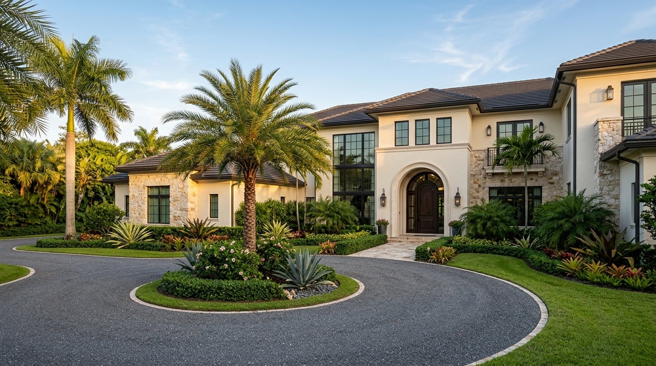
Port Royal sits on Naples’ southern peninsula, framed by the Gulf of Mexico to the west and Naples Bay to the east. It is a low‑density neighborhood known for estate‑scale lots and privacy. You’ll find three water settings that shape daily life: beachfront estates, bayfront homes, and deep‑water canal properties. For neighborhood context and community updates, visit the Port Royal Property Owners’ Association.
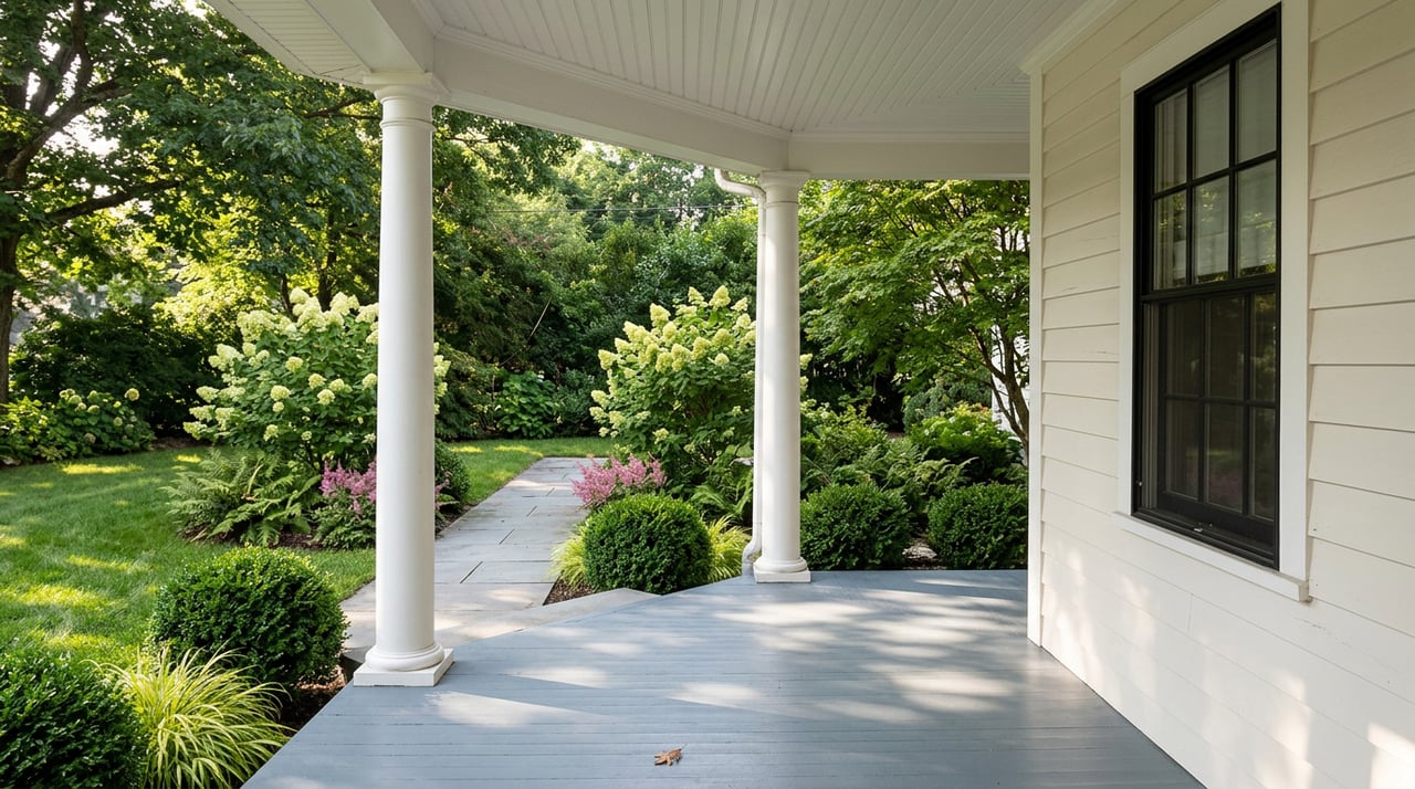
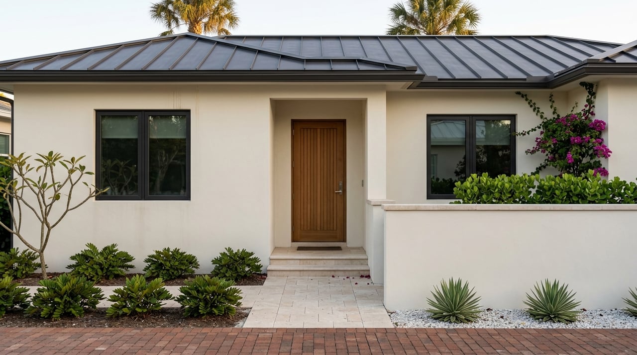
Beachfront estates
If you value waves and sunsets most, beachfront is your lane. These properties prioritize private beach access and views. Because homes front the open Gulf with dune protections and coastal rules, long private docks are not the norm here. Many buyers choose beachfront for the beach itself and use nearby marinas when they want to boat.
Bayfront living
Bayfront homes front Naples Bay, offering wide water views and sheltered dockage. You typically enjoy shorter runs to the main channel to reach the Gulf. Depths here tend to be more stable than outer sandbars, though you should still verify measured depth at low tide for any dock. For many owners, a bayfront setup balances views, calm water, and easy outings.
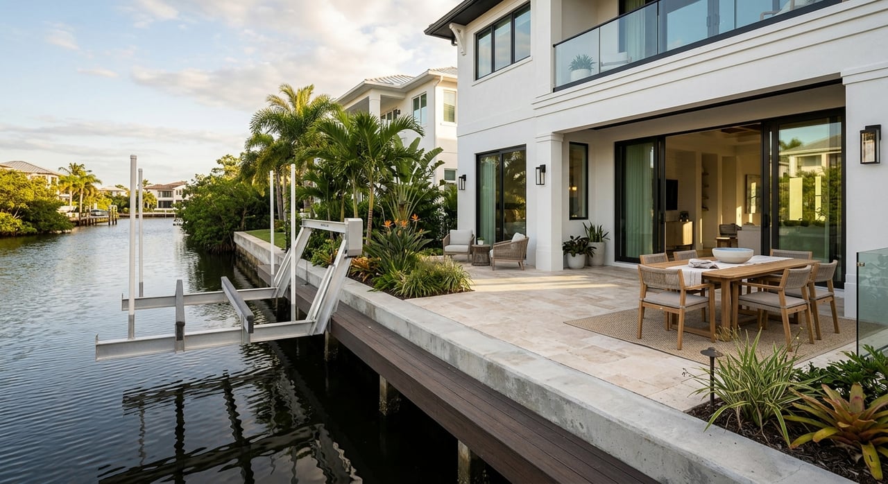
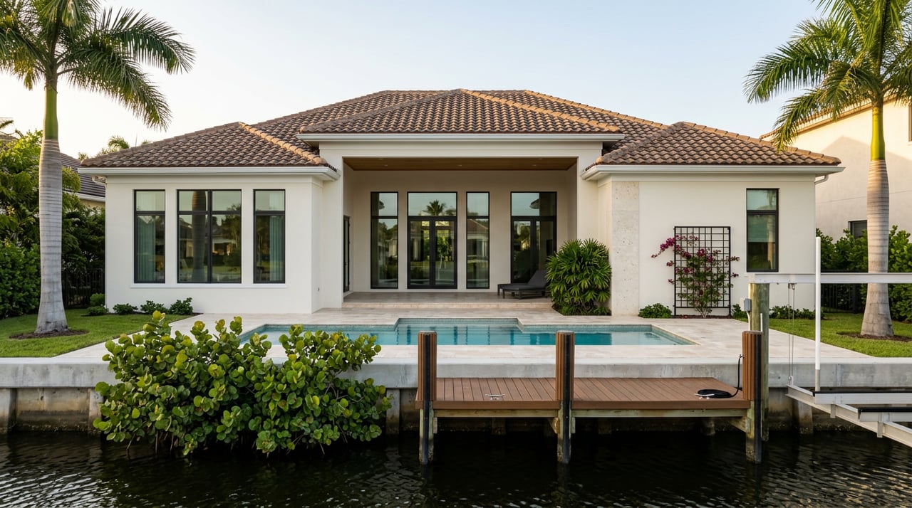
Deep‑water canal homes
Canalfront properties are often marketed as the choice for larger boats. Whether a specific lot can host a big yacht depends on three things: your permitted dock footprint, the measured depth at mean low water, and the canal’s width and turning room. Some canals can handle sizeable vessels, while others are better for center consoles or tenders. Treat every lot as unique and plan to verify the details.
Boat access and navigation
Gordon Pass and the federal channel
Your route to the Gulf runs through Gordon Pass and the federal navigation channel maintained by the U.S. Army Corps of Engineers. The project includes a 12‑foot‑deep, 150‑foot‑wide channel from the Gulf to Gordon Pass with 10‑ to 6‑foot sections through the pass and Naples Bay, plus turning basins. Review the USACE Naples to Big Marco Pass fact sheet for the official dimensions.
Natural shoaling and maintenance dredging
Inlets like Gordon Pass naturally shift and shoal. That is why periodic dredging keeps the channel safe for transit. The Jacksonville District shares updates, including recent awards for maintenance work in the federal channel. You can see the latest activity in the USACE dredging notice. Always check recent surveys and local reports before assuming available draft.
No low bridges to the Gulf
One advantage of Port Royal is the lack of low fixed bridges between most canals and the Gulf. That simplifies runs for taller vessels compared with some inland areas in Southwest Florida. Tides and inlet conditions still affect safe passage, so confirm your route’s draft and clearance for your specific boat.
Docks, permits and boat size limits
Port Royal dock rules that matter
Port Royal has legacy dock guidelines that differ from other parts of Naples. Key limits include a maximum 22‑foot dock protrusion from the seawall, a 100‑linear‑foot cap for a single or combined dock along a property, and side‑yard setbacks of roughly 20 feet. These numbers directly shape what you can build and the size of the vessel you can berth. See the City packet summarizing these rules in the Port Royal resident materials.
As a practical example, a 32‑foot boat with a 10.5‑foot beam already uses a large share of interior space under the 22‑foot protrusion limit. The takeaway is simple: measure your dream boat against the permitted dock footprint, not just the lot’s water frontage.
Depth and canal geometry
Even with a compliant dock, safe berthing depends on actual depth and turning room. Depths at private docks can vary due to shoaling and local conditions, and canal width affects how comfortably you can maneuver a wider beam. Port Royal canals connect to the federal channel, and the City has identified canal segments for periodic maintenance in the past. For a specific address, rely on a recent sounding at mean low water and site‑specific geometry, not neighborhood averages. City records and surveys help you confirm what is true today.
Seawalls and maintenance reality
Seawalls define your dock line and protect your property. Condition, age, and design type can affect near‑term budgets and permitting. Ask for professional inspection history and any city permits or engineer reports. The City shares background on seawall and canal maintenance coordination in its public materials.
Everyday boating convenience
Naples City Dock and services
Even if you keep a boat at home, it is nice to have a municipal dock within a short ride. The City of Naples operates the Naples City Dock at Crayton Cove with fuel, pump‑out, and transient dockage. Slip availability and policies can change, so call ahead for current details.
Clubs and private marinas
Many residents also join private clubs for dining, social events, and boating services. The Naples Yacht Club and other private facilities offer additional amenities and may have guest policies. Port Royal’s own beach club is a social hub for many neighbors; if membership is important to you, contact the Port Royal Club directly for current eligibility and timelines.
Recreation from your backyard
Backcountry days in Rookery Bay
South of Naples, the Rookery Bay National Estuarine Research Reserve and the Ten Thousand Islands form a vast inshore playground. You can explore mangrove tunnels, flats, and seagrass beds, with popular inshore species like snook, redfish, spotted sea trout, and mangrove snapper. Portions of the reserve have specific use rules, so review the Reserve’s guidance on the Rookery Bay NERR page before you go.
Offshore day trips and reefs
Once you clear the pass, offshore action is within reach on day runs. Seasonal snapper and grouper trips, plus pelagics at the right times, are a regular draw. Local reef programs and charter operators support these outings. For a sense of seasonal patterns, browse a recent regional fishing update.
Resilience, flood and insurance
Flood zones and insurance checks
Before you buy, pull the FEMA Flood Insurance Rate Map for the exact address. Flood zones affect lending and insurance requirements, and premiums continue to evolve as markets update risk models. Start with the FEMA Flood Map Search, and ask your insurance advisor for current quotes tied to the property’s elevation and construction.
Sea‑level rise planning
Like all low‑lying Gulf‑coast areas, Port Royal plans for storm surge, nuisance high tides, and long‑term sea‑level rise. Collier County and the City of Naples publish vulnerability assessments that show scenario‑based projections and maps. These are helpful screening tools as you evaluate site conditions and future plans. For a technical overview, see the County’s vulnerability assessment.
Buyer checklist: Port Royal waterfront
Use this simple checklist to focus your due diligence:
- Confirm dock permits. Ask, “Is there a permitted dock, and when was the last permit issued or renewed?” Review drawings and approvals. The City’s Port Royal materials outline the key dock limits referenced above.
- Verify measured depth. Get a recent sounding at mean low water at the dock face and out to the canal centerline. Compare to your vessel’s safe operating draft with a margin.
- Check dock layout against rules. Measure the permitted protrusion, total linear feet, and side setbacks at the parcel. Make sure your intended lift or T‑dock fits within the limits summarized in the Port Royal resident packet.
- Inspect seawall condition. Request engineer reports, age, and known repairs. The City’s seawall and canal references show how maintenance is coordinated.
- Map the route. Review the USACE channel fact sheet and any current dredging updates. Consider tides and local reports.
- Pull flood and insurance info. Start with the FEMA map search and request current quotes from your insurer.
- Confirm club priorities. If beach club access is important, contact the Port Royal Club for current membership options and timelines.
What this means for you
Living on the water in Port Royal is about more than a postcard view. Your daily experience depends on your lot’s orientation, your dock’s permitted footprint, and the real‑world depths you have at low tide. When you pair the right property with the right boat and route, Port Royal offers a rare mix of privacy, quick Gulf access, and year‑round recreation.
If you are weighing options, you do not have to decode it alone. With clear steps and the right local checks, you can buy with confidence and start enjoying life on the water.
Ready to talk through a specific address, dock plan, or pre‑offer checklist? Reach out to Donna Tidwell, Berkshire Hathaway for a confidential consultation or to Request Your Free Home Valuation.
FAQs
What types of waterfront are in Port Royal?
- You will find beachfront estates, bayfront homes on Naples Bay, and deep‑water canal properties. Each offers a different mix of views, dock potential, and Gulf access.
How fast can I reach the Gulf by boat?
- Most routes go through Gordon Pass into the federal channel. Runs are short from Port Royal, but speed and draft depend on your dock location, tide, and vessel.
What dock rules could limit my boat size?
- Port Royal materials cite a 22‑foot maximum dock protrusion, a 100‑linear‑foot dock cap, and side‑yard setbacks of about 20 feet, which together shape dock layout and vessel fit.
Do Port Royal canals have bridges to the Gulf?
- No low fixed bridges block most Port Royal routes to Gordon Pass, which helps with taller vessels. You should still confirm vertical clearance and draft for your route.
How do I check flood risk for a Port Royal home?
- Pull the FEMA Flood Map for the address and ask for current insurance quotes. Also review local vulnerability assessments to understand long‑term planning and scenarios.