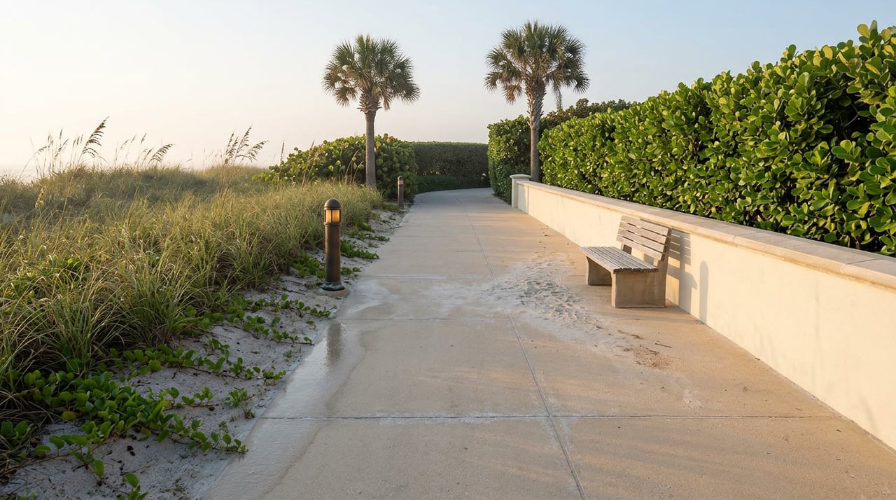
Walk north from Horizon House on a Tuesday morning and the concrete under your feet is new enough that you can still smell it in the heat. New railings. Fresh sea oats holding the dune. A bollard light that still has its factory shine. Keep walking past the Park Shore Association's beach park and the surface doesn't change, but the sign bolted to the post beside it does. Private beachwalk. No bicycles. No dogs. No trespassing beyond this point unless you own here.
That sign is the detail most people walking Gulf Shore Boulevard North this season miss, and it's the one that actually explains what happened to this stretch of coastline over the last four years.
What Got Rebuilt, and Who Actually Paid
The Park Shore promenade is not a public boardwalk. It never has been. Built by the Lutgert Company in the early 1970s as part of the original Park Shore development, the 1.2-mile concrete walkway from Horizon House on the south end to LeParc on the north was designed for the condominium owners along it, not for the city at large. For fifty years that distinction rarely mattered, because the walk simply worked and nobody thought about who owned the ground underneath it.
Hurricane Ian changed that in 2022. A 14-foot storm surge tore out long sections of concrete, destroyed the dune system, and took the lighting with it. Hurricanes Milton and Helene compounded the damage again in 2024. According to the Gulf Shore Association of Condominiums, the group that coordinates among the property owners along the walk, total reconstruction costs ran well over $15 million, funded entirely through assessments on the surrounding condominium unit owners. There was no FEMA check writing this into existence. Every dollar came from the people who live there, because the walk is theirs to fix, not the city's.
That's the part worth sitting with before anything else. The beachwalk isn't a single public asset that got repaired by a single authority. It's five separate strips of private beachfront, each belonging to its own commons association, each with its own board, each making its own decisions about when and how to rebuild.
Five Boards, One Walkway, No Single Owner
The five commons associations that make up the promenade are known internally as Commons R, S, T/U, V, and W. Each governs a different segment between Horizon House and LeParc, and each answers to the condominium properties that sit behind it. There is no master authority that can order all five to move at the same pace. GSAC coordinates and advocates, but it holds no ownership stake in the walk itself.
Practically, that means the "restored" status you'll see repeated across neighborhood guides is true in aggregate and uneven in fact. As of the association's report this past April, most of the walkway had been rebuilt, the dunes replanted, and turtle-friendly lighting reinstalled, but the association itself described a resiliency study covering the whole stretch as still underway rather than finished. If you're walking the full length expecting uniform footing, expect instead a walk that changes character commons by commons, because five different boards are five different timelines.
The rules along the way haven't changed even where the concrete has. Bicycles, dogs, and skating remain prohibited the entire length, a policy that predates Ian and was simply reinstalled with the new signage once each commons got around to it.
Where the Walk Actually Breaks
Two things stop the promenade cold no matter which commons you're standing in.
The first is Doctors Pass, the jettied inlet where Park Shore's beachfront ends and the Moorings begins. There's no bridge along the sand here. If you're on foot or on a bike and you hit the pass, the route picks back up on the other side only if you detour inland, over the Park Shore Drive or Harbour Drive bridges to Crayton Road, then back out to Gulf Shore Boulevard.
The second is ownership itself. Because the walk is private property held by condo owners, public access exists only at its edges. Two access points serve as the practical entry and exit for anyone without a unit along the beach commons:
| Access Point | Location | Parking | Best For |
|---|---|---|---|
| Via Miramar Park | North of Doctors Pass | 42 metered spaces | Southern end, near the jetty, shore fishing for snook and jack crevalle |
| North Gulfshore Beach Access (Seagate) | Seagate Drive at Gulf Shore Blvd N | Small county lot, no car through-access | Northern end, quieter stretch |
| Raymond Lutgert Park | Park Shore Drive at Gulf Shore Blvd N | Member-only, gated | Park Shore Association members with an active annual pass |
Forty-two metered spaces at the south end and a handful more at Seagate is the entire public footprint for a promenade that runs 1.2 miles and serves nearly 2,000 condominium owners along it. That ratio is the honest reason the walk still feels like a residents' amenity rather than a public one, regardless of how finished the concrete looks from the street.
The Six-Foot Problem Nobody's Solved Yet
Here's the part that actually matters more than any of the concrete, and it's the piece that hasn't been finished at all.
In front of the Park Shore Association's beach park, the rebuilt promenade sits on a berm roughly six feet high. Further north, an older section of dune and walkway was already elevated higher, and by the Park Shore Association's own account, that higher ground held up better during the 2024 storms, Helene and Milton, than the lower sections did. The lesson landed. The proposal that followed did not.
As of the association's last public update on the project, from May 2025, discussions were underway to more than double the berm height in front of the beach park, matching it to the elevated structure to the north. PSA board president Nancy Walkenhorst had been included in those planning sessions specifically to keep the association's interests aligned with whatever the commons boards eventually agree to build. But the project still needed sign off from the Florida Department of Environmental Protection and the City of Naples, and the boards involved were still working through financing before any of that permitting could move forward. No completion date had been set, and no newer public update on the berm's status had surfaced since.
That's the gap. The visible recovery, the part every neighborhood guide points to, is the concrete, the lighting, the landscaping. It's done, or close to it, and it photographs well. The invisible recovery, the six extra feet of sand and structure that actually determined which properties held up better against Helene and Milton, is still a proposal sitting in a permitting queue well over a year later.
Why This Matters Right Now, Not Later
Atlantic hurricane season runs through the end of November, which means Park Shore is currently living inside the exact window the berm project is meant to protect against, with that project still unbuilt. The walk looking finished is not the same claim as the neighborhood being storm ready. Those are two different recoveries running at two different speeds, and only one of them is actually complete.
If you live along this stretch, the practical takeaway isn't alarm. It's accuracy. Know which commons your building sits behind, know that the berm decision in front of the PSA beach park hasn't been made yet, and don't mistake a walkable path this September for a resolved conversation about how the next storm surge gets handled. The five boards that rebuilt the concrete are the same five boards that still have to agree on the part that matters more.
Donna Tidwell has spent decades watching Naples neighborhoods work through exactly this kind of slow, board-by-board recovery, and she knows the difference between what a listing photo shows and what a homeowner actually needs to understand before the next season arrives. If you've got questions about how a specific building or commons segment fits into this picture, or what any of it means for a property you already own here, Donna Tidwell is a straightforward call away.